Dátový katalóg geoPresovRegion
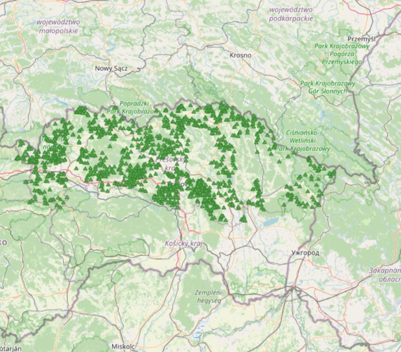
Turistické informačné tabule
Vrstva turistických informačných tabulí je exportovaná z databázy OpenStreetMap.
OpenStreetMap je otvorený projekt, ktorého cieľom je tvorba voľných geografických dát. Používa predovšetkým dáta z prijímačov GPS (v režime automatického zaznamenávania súradníc prechádzanej trasy), ktoré sú následne kontrolované a editované. Je založený na kolektívnej spolupráci a na koncepcii Open source.
Simple
- Date (Revision)
- 2020-04-16
- Citation identifier
- 3c71272b-aae0-4cdb-bbff-5e3eeb86b01d
- Status
- On going
- Point of contact
-
Organisation name Individual name Electronic mail address Role Open Street Map
openstreetmap.org
Resource provider
- Maintenance and update frequency
- As needed
- Theme
-
-
Keywords
-
-
otvorený softvér
-
cestovný ruch
-
- Use constraints
- Other restrictions
- Other constraints
-
Creative Commons Attribution 4.0 International (CC BY 4.0)
- Access constraints
- Other restrictions
- Other constraints
- Bez obmedzenia prístupu
- Spatial representation type
- Vector
- Denominator
- 5000
- Language
- Slovak [SK]
- Character set
- UTF8
- Topic category
-
- Society
))
- Supplemental Information
-
You can customize the template to suit your needs.
You can add
and remove fields and fill out default information (e.g. contact
details).
Fields you can not change in the default view may be accessible in the
more
comprehensive (and more complex) advanced view. You can even use the
XML editor
to create custom structures, but they have to be validated by the
system, so
know what you do :-)
- Reference system identifier
- EPSG:3857
- Distribution format
-
Name Version gml+xml 3.2
- OnLine resource
-
Protocol Linkage Name OGC:WMS
https://geopresovregion.sk/geoserver/wms/ geo-psk:osm_turisticke_info_tabule
WWW:DOWNLOAD-1.0-http--download
https://geopresovregion.sk/geoserver/geo-psk/ows?service=WFS&version=1.0.0&request=GetFeature&typeName=osm_turisticke_info_tabule&outputformat=SHAPE-ZIP OGC:WFS
https://geopresovregion.sk/geoserver/wfs geo-psk:osm_turisticke_info_tabule
- Hierarchy level
- Dataset
Conformance result
- Alternate title
-
Commission Regulation (EU) No 1089/2010 of 23 November 2010 implementing Directive 2007/2/EC of the European Parliament and of the Council as regards interoperability of spatial data sets and services
- Date (Publication)
- 2010-12-08
- Explanation
-
Viď Nariadenie Komisie (EÚ) č. 1089/2010
- Pass
- No
- Statement
-
Povinné - vyplniť / Mandatory (INSPIRE)
Metadata
- File identifier
- 3c71272b-aae0-4cdb-bbff-5e3eeb86b01d XML
- Metadata language
- Slovak [SK]
- Character set
- UTF8
- Hierarchy level
- Dataset
- Date stamp
- 2021-09-01T08:25:04Z
- Metadata standard name
-
ISO 19115:2003/19139
- Metadata standard version
-
1.0
- Metadata author
-
Organisation name Individual name Electronic mail address Role Prešovský samosprávny kraj - kontakt
Inštitút rozvoja PSK - GIS tím
Author
Overviews
Spatial extent
Provided by